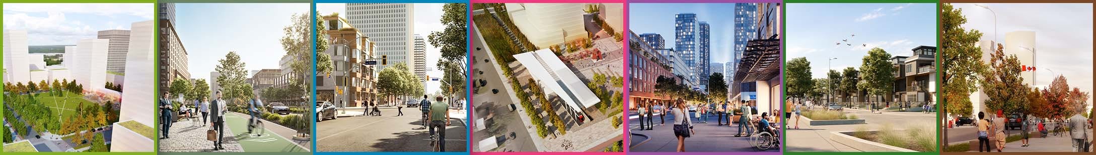
Proposed Complete Street and Active Transportation Network
The proposed Complete Street and Active Transportation Network for Tunney’s Pasture was presented to the City of Ottawa at a Pre-consultation meeting on May 9, 2024. The public was invited to review the preliminary Tunney’s Pasture Complete Street and Active Transportation Network at open houses in November 2023.
The pre-consultation is the first step in the process to have the federal roads at Tunney’s transferred over to the City. It provides all City departments with an opportunity to ask questions and give feedback on the network before the Plan of Subdivision is formally submitted.
In July 2025, the project team submitted the Draft Plan of Subdivision application which is now deemed complete by the City and documents are available for the public’s view: Tunney’s Pasture Draft Plan of Subdivision – DevApps.
On September 22, 2025, Councillor Jeff Leiper hosted Public Information Session to provide residents an opportunity to learn more about the Draft Plan of Subdivision and provide community feedback.
Once approved, the network will form the spine of this future vibrant community. It is a foundational step in creating a human centric, pedestrian-friendly site, and will ensure that Tunney’s Pasture connects to surrounding neighbourhoods and the Ottawa River.
With the Draft Plan of Subdivision process underway, the next phase in the project will be the transfer of the roadways and select land parcels from PSPC to Canada Lands. Canada Lands will complete the necessary roadway and infrastructure upgrades required to enable lands to be made available for housing and affordable housing in alignment with the established vision for the project.
We also invite you to view a short video(External link) detailing the journey of the Tunney’s Pasture Redevelopment project and how we arrived at the proposed Complete Street and Active Transportation Network.
